© 2003-2007 Clearwater Hydrology
2974 Adeline St. Berkeley, CA 94703 | (510) 841-1836 | (510) 841-1610
Home | Services | Project Examples | Staff | Clients | Sitemap | Contact Us
Technical Services
Site Surveys & Topographic Data Collection
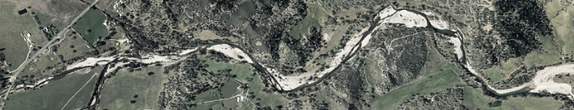
Clearwater Hydrology (CH) has topographic and spatial measurement equipment, including a Total Station and laser level equipment. Using this equipment, CH can collect detailed existing condition, as-built or monitoring information for project construction sites affecting stream corridors; or can generate detailed topography for small sites to augment stream corridor topography collected as part of aerial, or other, surveys for larger sites.
Topographic surveys completed for larger sites often have limited resolution within the stream corridor due to dense riparian vegetation and the focus of most development activities on the upland portions of project sites. Generating an accurate topographic representation of a stream corridor is essential for hydraulic modeling, urban setback determinations and development of viable stream/habitat restoration designs.
AutoCAD & GIS Data Analysis and Presentation
Our GIS and AutoCAD capabilities permit the processing of detailed topographic data into clear graphics for presentation, and 3-D surfaces for hydraulic modeling and restoration design. These capabilities permit CH to integrate and analyze a wide variety of hydrologic, hydraulic, and environmental data based on the spatial inter-relationships among the data. CH generates floodplain mapping, grading plans and stream restoration designs in AutoCAD using 3-D design techniques. This design methodology, in conjunction with detailed topographic data, generates restoration designs that are constructible within site constraints, with a minimum of change orders and allows accurate computation of cut and fill volumes.
Hydrologic, Hydraulic and Water Quality Modeling
CH conducts hydrologic and hydraulic modeling to examine physical flow characteristics and water quality in stream, river, estuarine, and built environments. Typically, we combine hydrologic modeling with hydraulic modeling to provide an integrated analysis representing the entire watershed, urban and rural. CH uses publicly available one- and two- dimensional models, such as HEC-HMS, HEC-RAS with the recently integrated sediment analysis component, and EPA’s SWMMM model, as well as proprietary models. Additionally, CH will develop models, starting from the governing PDEs, to use in situations where existing models do not adequately represent the physics of a particular problem.
Sediment Analysis
CH collects information in the field concerning sediments in riparian and wetland environments. CH also compiles and analyzes laboratory data of field sediment samples for both representation of field conditions and design. This detailed sediment information is employed for vegetation substrate characterization, geomorphic assessment, and hydraulic assessment.
Geomorphic Analysis
The core strength of Clearwater Hydrology is the integration of topographic data, hydraulic and hydrologic modeling, and sediment analysis into a comprehensive geomorphic analysis of a riparian or wetland site. A variety of geomorphic classification criteria can be employed as part of this analysis. Geomorphic analysis then guides restoration design towards a stable configuration that is appropriate to, and integrated with, the surrounding landscape.
Complete List of Services
Return to our Consulting and Engineering Services Page